India Map
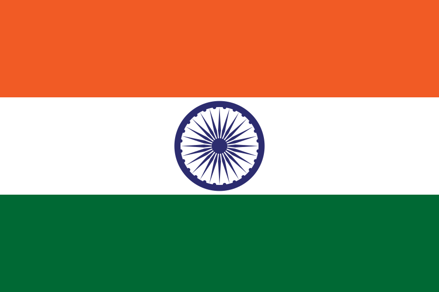
Capital: New Delhi
Population: 1,463,865,525 (2025 UN estimate)
Area: 3,287,263 km²
Currency: INR
Languages: Hindi, English
Religions: Hinduism, Islam, Christianity
Time zone: UTC+5:30
About India
India occupies most of the Indian subcontinent, the great wedge of land that runs from the Himalaya south into the Indian Ocean, with the Arabian Sea on its west and the Bay of Bengal on its east. Its population of roughly 1.46 billion (2025 UN estimate) has been the largest of any country since 2023, when it passed China. By area it is the seventh-largest country: the official figure of 3,287,263 km² includes all of the former princely state of Jammu and Kashmir, parts of which are administered by Pakistan and China (see below). New Delhi is the capital, and the country is a federal parliamentary republic of 28 states and 8 union territories.
Despite spanning almost 30 degrees of longitude, the whole country runs on a single time zone, Indian Standard Time (UTC+5:30). In the far northeast the sun can rise before 5 a.m. in summer, while in western Gujarat it sets after 7:30 p.m.
The lie of the land
India's physical map falls into a few broad belts. Across the north is the Himalaya, from Ladakh and Himachal Pradesh in the west through Uttarakhand and Sikkim to Arunachal Pradesh in the east. India's highest peak, Kangchenjunga (8,586 m), the third-highest mountain in the world, sits on the Sikkim–Nepal border. South of the mountains is the Indo-Gangetic Plain, a flat, deeply fertile alluvial lowland fed by the Ganges, the Yamuna and their tributaries. It is the most densely settled part of the country, home to Uttar Pradesh, Bihar and West Bengal. To the west, the plain dries out into the Thar Desert of Rajasthan, which continues into Pakistan, and further south into the salt flats of the Rann of Kutch in Gujarat.
The southern half of the country is the Deccan Plateau, an old block of volcanic and crystalline rock that tilts gently east. It is rimmed by the Western Ghats, a forested escarpment running about 1,600 km parallel to the Arabian Sea coast and a UNESCO World Heritage biodiversity hotspot, and by the lower, broken Eastern Ghats. Narrow coastal plains line both shores: the Konkan and Malabar coasts in the west, the Coromandel coast in the southeast. India also has two island groups, the Andaman and Nicobar Islands far out in the Bay of Bengal and the coral atolls of Lakshadweep in the Arabian Sea. The country's southernmost point, Indira Point on Great Nicobar, is only about 150 km from Indonesia's Sumatra.
The rivers follow the same pattern. The Himalayan rivers (the Ganges, the Brahmaputra, which enters from Tibet through Arunachal Pradesh, and the Indus, which crosses Ladakh) are fed by snow and glaciers and flow all year. The peninsular rivers depend on the monsoon. The Godavari, Krishna and Kaveri drain east to the Bay of Bengal, while the Narmada and Tapti are the main rivers flowing west to the Arabian Sea. The Ganges and Brahmaputra meet in Bangladesh to form the world's largest delta, whose Indian portion holds the mangrove forest of the Sundarbans. More on these systems: rivers of Asia and mountain ranges of Asia.
Monsoon seasons and when to visit
The Indian year is shaped by the southwest monsoon, which usually reaches the Kerala coast around the start of June, covers most of the country by early July and withdraws during September and October. It delivers the bulk of the annual rain that Indian farming depends on. The northeast, especially Meghalaya, where Mawsynram and Cherrapunji (Sohra) are among the wettest places on Earth, and the Western Ghats get the heaviest rain. Tamil Nadu, by contrast, gets much of its rain from the northeast monsoon in October to December.
- October to March is the best time for most of the country: dry, sunny and mild on the plains, with cool, sometimes foggy nights in Delhi and the north from December to January.
- April to June brings intense pre-monsoon heat. Temperatures above 45 °C are common in Rajasthan and the northern plains, and this is when hill stations such as Shimla, Darjeeling and Ooty fill up.
- June to September is the only practical window for high-altitude Ladakh and Spiti, which lie in the rain shadow of the Himalaya, while the monsoon turns Kerala and the Ghats lush and green.
People, languages and faiths
India's constitution makes Hindi, written in Devanagari script, the official language of the Union, with English as an additional official language. The Eighth Schedule recognises 22 languages, among them Bengali, Marathi, Telugu, Tamil, Gujarati, Urdu, Kannada, Odia, Malayalam and Punjabi. Many states were redrawn along linguistic lines after 1956, so the state map is also roughly a language map. Hindi is spoken mostly across the north. The south speaks Dravidian languages (Tamil, Telugu, Kannada, Malayalam), which belong to an entirely different family. See languages of Asia for the regional picture.
At the 2011 census, the most recent completed (the next is scheduled for 2027), about 79.8% of Indians were Hindu, 14.2% Muslim, 2.3% Christian, 1.7% Sikh, 0.7% Buddhist and 0.4% Jain. India is the birthplace of Hinduism, Buddhism, Jainism and Sikhism, and has one of the world's largest Muslim populations. Bodh Gaya in Bihar, where the Buddha is said to have attained enlightenment, Varanasi on the Ganges and the Golden Temple in Amritsar are among its major pilgrimage sites. More in religions of Asia.
Major cities
- Delhi, which contains the capital, New Delhi, on the Yamuna. Its urban area spills into neighbouring states (Gurugram, Noida, Ghaziabad) and is one of the largest in the world. Old Delhi's Red Fort and Jama Masjid date from the Mughal capital, Shahjahanabad.
- Mumbai, the capital of Maharashtra and India's financial centre, home to the main stock exchanges, the Reserve Bank of India and the Hindi film industry, built on former islands on the Arabian Sea.
- Bengaluru (Bangalore), capital of Karnataka, set on the Deccan Plateau at about 900 m, which keeps it milder than the coast. It is the centre of India's software and start-up industry.
- Hyderabad, capital of Telangana, a major IT and pharmaceutical hub, whose old city is built around the 16th-century Charminar.
- Chennai, capital of Tamil Nadu on the Coromandel coast, a large car-manufacturing centre and port.
- Kolkata, capital of West Bengal on the Hooghly River, capital of British India until 1911 and still the main city of eastern India.
- Ahmedabad, Gujarat's largest city on the Sabarmati River. It is a textile and trading centre, and its walled old city is a World Heritage Site.
History that shaped the map
Urban civilisation in the subcontinent goes back to the Indus Valley (Harappan) culture, which flourished around 2600–1900 BCE. Its best-known cities, Harappa and Mohenjo-daro, are now in Pakistan, while Dholavira and Lothal are in Gujarat. Later empires (the Mauryas under Ashoka in the 3rd century BCE, the Guptas, the Delhi Sultanate and the Mughals from the 16th century) unified large parts of the subcontinent at different times. The British East India Company expanded from coastal trading posts in the 18th century, and the British Crown ruled directly from 1858.
Independence in August 1947 came with Partition: British India was divided into India and Pakistan, whose eastern wing became Bangladesh in 1971. India became a republic on 26 January 1950. Since then the internal map has been redrawn repeatedly. Goa joined in 1961, Sikkim in 1975, and Telangana was carved from Andhra Pradesh in 2014. In 2019 the state of Jammu and Kashmir was reorganised into two union territories, Jammu and Kashmir and Ladakh.
Borders and disputed areas
India has land borders with Pakistan, China, Nepal, Bhutan, Bangladesh and Myanmar. The border with Bangladesh, at about 4,100 km, is the longest. The border with Nepal is open, so citizens of both countries cross without visas. Two frontiers remain disputed. In Kashmir, the Line of Control separates India-administered areas from Pakistan-administered Azad Jammu and Kashmir and Gilgit-Baltistan, and both countries claim the whole region. The most recent serious fighting, in May 2025, followed a militant attack at Pahalgam in Indian-administered Kashmir and ended in a ceasefire on 10 May. India has since said it is holding the 1960 Indus Waters Treaty "in abeyance", a position Pakistan rejects. With China, the Line of Actual Control runs through Ladakh, where China administers Aksai Chin, which India claims, and in the east China claims most of Arunachal Pradesh. By sea, Sri Lanka lies across the narrow Palk Strait and the Maldives to the southwest.
India is a founding member of SAARC and belongs to BRICS, the G20 and the Shanghai Cooperation Organisation. By nominal GDP it is one of the world's five largest economies, but output per person is still about US$2,700 (World Bank, 2025), and services (especially IT), pharmaceuticals, engineering and agriculture all weigh heavily. For travel distances to its neighbours' capitals, see Delhi to Karachi, Delhi to Mumbai and Delhi to Dubai.